Yellow Aster Butte Trail Information
Yellow Aster Butte Trail
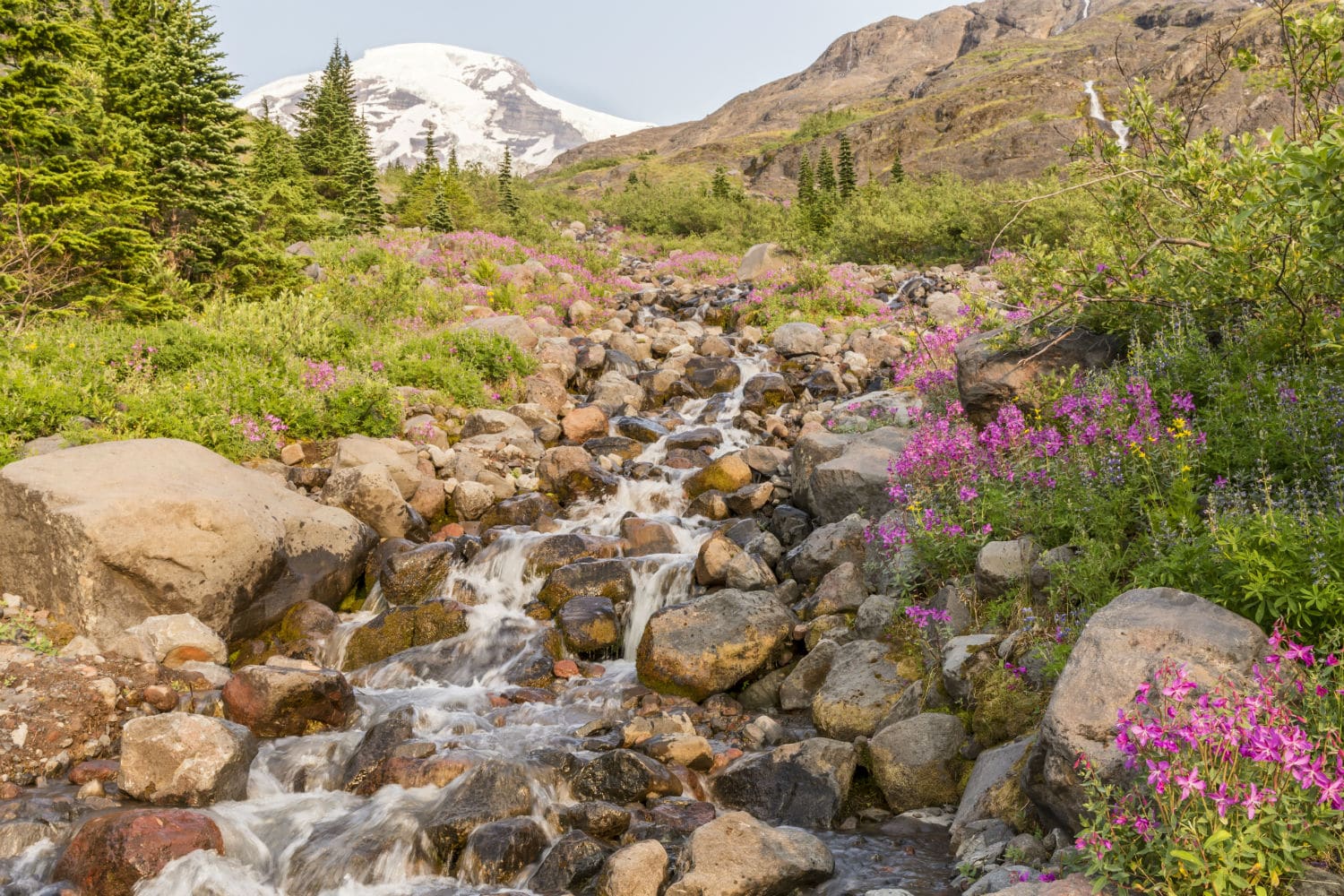
The Yellow Aster Butte trail is located in Washington State, USA. The 6.8 mile trail has an elevation gain of 2550 feet. It is rated a moderate difficulty hike. Hikers can experience views of Mt. Baker, Mt. Larrabee, and Mt. Shuksan. Due to avalanche paths that exist on the trail, it is highly recommended to hike this trail between July and October. Parking space is limited to 20 spaces, so coming early is also recommended.
Location: Near Glacier WA.
Rating: Moderately Difficult
Length: 6.8 mile
Elevation: 2550 feet
Points of Interest: Views of Mt. Baker, Mt. Larrabee, and Mt. Shuksan
Weather: Due to avalanche paths that exist on the trail, it is highly recommended to hike this trail between July and October. Check trail conditions before visiting.
Parking and Access: Parking space is limited to 20 spaces, so coming early is also recommended.

The Yellow Aster Butte trail is nestled within the stunning Cascade Mountains located less than 3 miles from the Canada-United States border. The scenic trail is located near the town of Glacier in Washington State. The Yellow Aster Butte hike is a beacon for the inspiring natural beauty that can be witnessed in the State of Washington. The 6.8 mile out-and-back trek is rated a moderate level of difficulty, striking a perfect balance between challenging hikers and allowing their minds to take in the wonders of their surroundings. The 2550 feet elevation gain will transport you into a painting of the Pacific Northwest. As you embark on the picturesque Yellow Aster Butte, you’ll be met with an immediate welcoming ascension. After emerging from the forest, you will be greeted by hues of red, yellow, orange and green created by the meadow flowers. Among the intertwining calming creeks and forest area, there will be expansive views of snowcaps in the distance. The scenery includes vistas of Mt. Baker, Mt. Larrabee, and even into Canada.
Hikers who enjoy wildlife will not be disappointed to learn that the trail is a treasure trove of various charming animals. Bird watchers can expect to find birds ranging from Golden Eagles soaring in the skies above the ridges to varied thrushes singing songs in the interspersed forests. You will be kept company with adorable marmots, pikas and deer.
Those who wish to bring their dogs are welcome to do so, the furry companions can come as long as they are leashed. It is recommended for hikers to go on the trail between the months of July and October. There are avalanche paths, simply meaning it is highly recommended to visit between the aforementioned months. Visit these websites for information about road closures and seasonal roads: https://www.alltrails.com/trail/us/washington/yellow-aster-butte-trail, https://www.fs.usda.gov/alerts/mbs/alerts-notices,https://www.wta.org/go-hiking/hikes/yellow-aster-butte
For new hikers, according to the USDA, passes are required at the trailhead to enter. Given the popularity of the trail and the limited road side parking allowing for approximately 20 vehicles, it’s recommended you come early to secure yourself a spot.
The Yellow Aster Butte trailhead is accessed via the Tomyhoi/Yellow Aster Butte Trailhead. To reach it, take a turn from Mt. Baker Highway onto Forest Road NF-3065. The turnoff is approximately 13 miles west of the town of Glacier WA or just under 8 miles from the Mt. Baker Ski Area.